|
morning • afternoon • orientierung
|
Graustock
Engelberg
2003 09 22 |

|
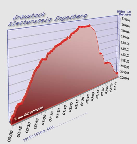
GPS
Höhenprofil
auf Kletterzeit
bezogen
Der Abstieg wirkt steiler, weil mehr Höhenmeter in kürzerer Zeit
geschafft werden als beim Klettern.

|
 |
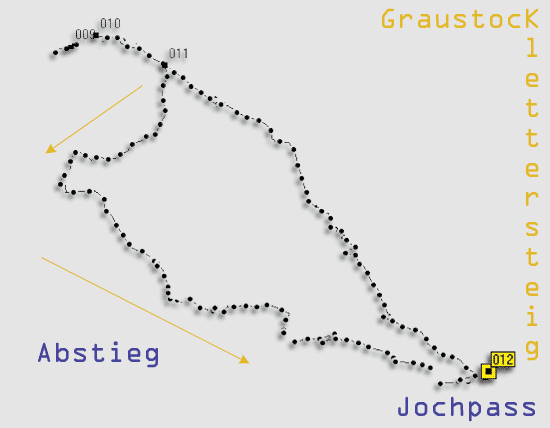
GPS
Tracklog
|
 |
GPS
Koordinaten
|
|
|
Beschreibung |
Position |
Altitude (ca.) |
|
012 |
Bergstation Jochlift |
N46 46.700 E8 23.190 |
2223.4 m |
|
009 |
Gipfelgrat |
N46 47.276 E8 22.137 |
2667.0 m |
|
010 |
Wandbuch |
N46 47.295 E8 22.200 |
2640.1 m |
|
011 |
Abzweigung |
N46 47.242 E8 22.375 |
2608.4 m |
|
Graustock
2003 09 22 |
|